I think it's about time for the next installment in the Excursions series.
One area I was always interested in this a long time back has been transportation-related infrastructure like roads and rail. And a fact that comes up quite naturally along that is the “sidedness” of traffic in different countries. Today a majority makes use of right-hand traffic, but this has changed over the cause of time. It is sometimes said the prevalence of right-hand traffic in Europe (and the Western world in general) is related to Napoleon and him wanted to keep England “at arms length”. This seems to quite disputed though…
But rather that going through various countries handedness here. I thought we should look at something more interesting and quirky. Because as it turns out, it's not always the case that the standard is entirely the same within a single country.
For the first example we could take the United States. Driving on the right, right?
Well, mostly, but there's an exception as it turns out:
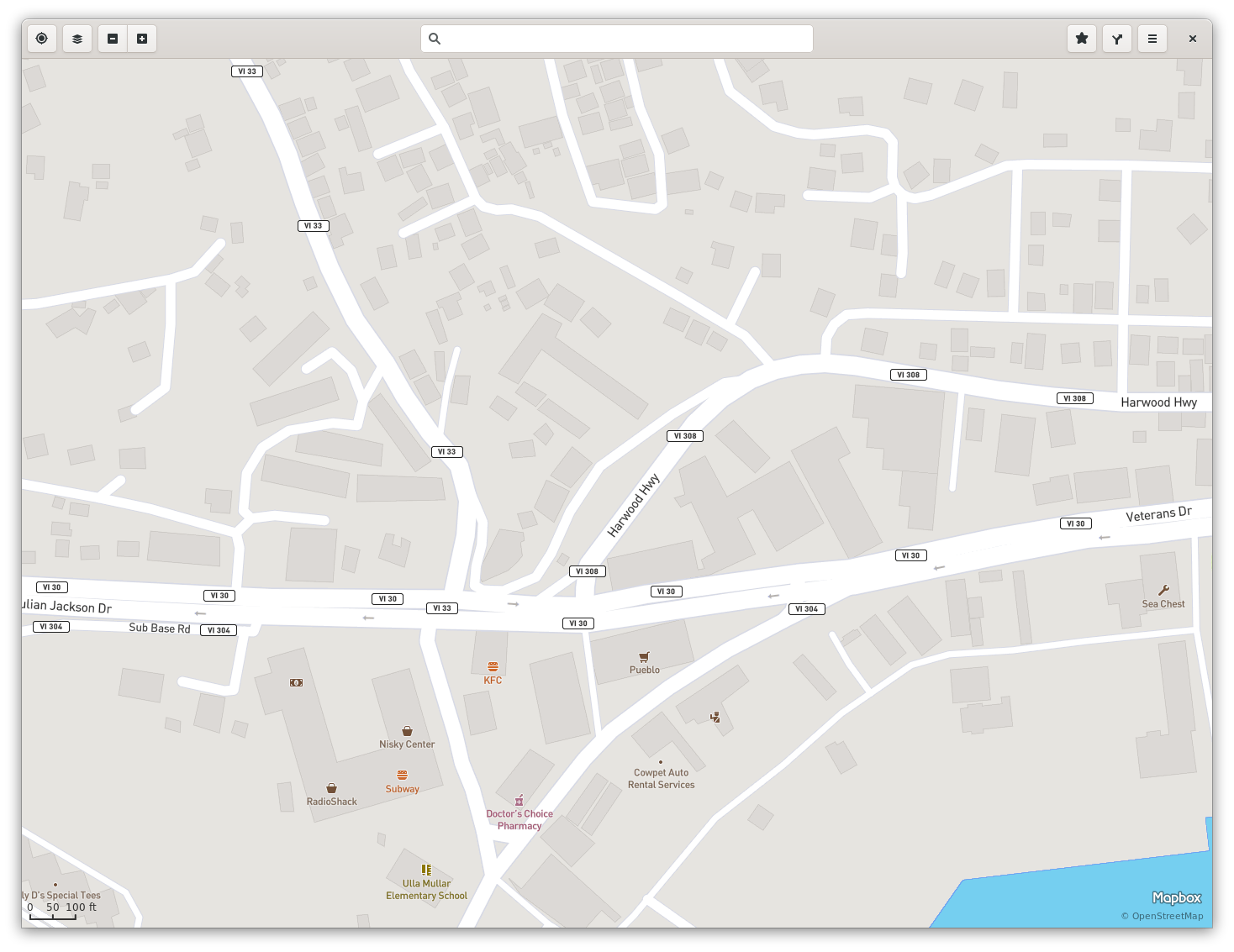
The territory The US Virgin Islands is actually left-hand traffic.

https://openstreetmap.org/relation/286898

Here we can see a map view of the capital city Charlotte Amalie, and on the follow view we can clearly see LHT on a dual carriageway street:
And talking about the United Kingdom (LHT, and remember the Napoleon remarks…). Despite being a well-known LHT example, especially in a European context, there's a part of the UK practicing RHT. Namely Gibraltar:

Always sharing land border with Spain this was more practical it seems…
Another quirky feature in Gibraltar is the level-crossing with the runway on the airport on the main road (connecting with Spain) Winston Churchill Avenue (Wikipedia)

It has crossing gates and lights, pretty much like on a railroad crossing… except when it's ringing, a Boeing 737 might zip by…
Next we go east to Hong Kong. Under British influence Hong Kong practiced left-hand trafic. And this has been kept also after 1997. Thus on the borders to mainland China contraptions like these can be seen to facilitate switching sides:

And not far from there we have a similar situation in Macao. When Macao was a Portuguese colony from the 16th century until 1999. And while Portugal itself switched from LHT to RHT in 1928, in Macao LHT continued, and it has been retained. A similar “trafic carousel“ as in the Hong Kong case can be seen at the mainland side of the Lótus Bridge (Wikipedia).

On the more quirky historical case is a road near the lake Björkvattnet (geo:64.608587,13.700729;crs=wgs84;u=0) in Jämtland in Sweden. While Sweden was LHT until 1967, neighboring Norway had been practicing RHT since a long time before. So when a new road was built between Kvelia and Tunnsjø (in Norway), the shortest and most conveniant option was to build the road for a stretch through Sweden. But imposing left-hand trafic on this single and at the time not connected to other roads in Sweden seemed inconvenient. So this road (and residents living there) was just practising RHT. And the only connections where through Norway anyway (the Z822 road leading to Gäddede and connecting to the rest of the Swedish road network was not built until some time after 1967, I think I read some discussions on this and when the roads where built at some forum, but I can't find those again…).

And also speaking of quirks, we also have the Punte Umberto I bridge in Rome https://openstreetmap.org/relation/5679034

The bridge itself is actually LHT (fortunately, maybe, there's a median fence).
And while speaking of countries switch sides, it seems historically it's been most common switching from LHT to RHT. But there's case of the opposite as well. After WWII Okinawa was occupied by the United States and RHT was practiced there, but in 1978 (six years after control of the islands was returned to Japan) they switched back to LHT.

https://openstreetmap.org/relation/4556086
Arguably this could be seen more as a case of reverting back to how it was before and getting back to the standards in the rest of the country. But still a bit interesting, I think.
And there is actually plans for a country as a whole to switch from RHT to LHT. And this is in Rwanda. The motivation would be that neighboring countries are predominantly LHT, so besides benefits of being similar to neighbors, prices of used vehicles with the steering wheel on the right side are generally lower.
Here's a map view from the capital Kigali:

https://openstreetmap.org/node/60485579
And by the way, if you use GNOME Maps, you can paste the openstreetmap.org URLs and geo: URIs directly into the search bar to go to these places.
So, let's see what we should explore next time!
There is an interesting case of RHT inside the heart of a country using LHT: the Savoy Hotel court in London
ReplyDeletehttps://www.theguardian.com/notesandqueries/query/0,5753,-1501,00.html
Aha, interesting! I'll check that one out!
DeleteAnd there's also numerous examples in bus stations for practical reasons with island platforms and things like that.
Also another interesting example is Angeredsbanan in Gothenburg in Sweden. While the rest of the tram network uses RHT (like road trafic in general since 1967) this section was built as a pre-metro intended to eventually be part of a fullsize metro system. So on this outer section uses island platforms, and since the trams used are single directional and only have doors on the right side, it uses LHT on this section.