
It's only a couple of days left until that weekend of the week of the turn of month between January and February, and that means it's time again for FOSDEM, gathering FOSS entusiasts in Brussels, Belgium. And I will be there as well!
There has been some nice improvements in Maps since the end-of-year post before New Years as well.
James Westman has continued improving vector rendering support in libshumate and also implemented the ability to click on symbols, so you can finally click on labels and icons on the map instead of using the „What's here?” context menu item, doing a reverse geocoding. That always felt a bit like a „work around”. This seems like one of those cases of „a video says more than a thousand images”.
This is available when enabling the experimental vector map layer.
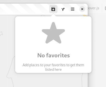
Another thing I have been working on is improving the experience of the favorites menu. Now instead of showing an insensitive, greye-out button in the headerbar when there are no places marked as favorites now the menu is always accessible, but instead shows an „empty state” when there are no places marked as favorites.
When there are places marked as favorites, there is now a close button next to the item allowing to remove it from favorites (rather than having to select the place and animate there to unmark the star icon in the popover showing).

When removing a favorite from menu a „toast” is displayed offering to undo this action (similar to when e.g. deleting files in Files).

Jakub Steiner has redesigned the map pin icon.


Compared to the old Tango-style icon that, while being a nice icon that has served us well looked a bit out-of-place in relation to the new UI style with a more 3D look.

Another new feature was thought up when looking for a cafe in a shopping mall in Riga during GUADEC last year is showing information about the floor location of places. There two established tags in OSM for this: level which represents the number of floors relative to the ground floor (or the lowest ground floor for buildings built in a souterrain fascion). In this case we now show this information in a spelled-out form for ground level or above, or below ground level (with provision for using localized plural forms).


The other tag is level:ref referring a literal floor designation as „written in the elevator“. This could be fully spelled-out named floors, or numbers with suffixes and so on. When this is available we'll refer to that one as this would directly correspond to actual writing on-site.

Lastly James has added support for showing descriptions in the info bubble when clicking on points in a GeoJSON shape files when present. It also now shows the name of the shape file in the info bubble (this shape file was from an old GUADEC in Strasbourg).

Maybe I forgot something, but I think those where the highlights of new stuff so far in 2024.
Maybe see you in Brussels in a couple of days!