Thought it was time to share some news on Maps again.
After the 42.0 release I have been putting down some time to do some spring cleaning in Maps to slim down a little bit on the code.
This would also mean less stuff to care about later on when porting to GTK4.
First we have the “no network” view.
We used to use the network monitor functionality from GIO to determine if the machine has a usable connection able to reach the public internet to avoid showing incomplete map tile data (where some parts might be cached from earlier, while others are missing).
Unfortunately there has been some issues with some setups not playing well NetworkManager (such as some third-party VPN software). So we have had several bug reports around this over the years.
At one point we even added a CLI option to bypass network checking as a sort of “workaround”. But now we decided to remove this (and along with some widgetry), and just rely on the user having a useful connection. The search and route functionality should still behave well and show error messages they were unable to read from the connections.
Moreover, we dropped the dependency on GOA (gnome-online-accounts), and the remaining support for user check-in using Foursquare, as this has been pretty flaky (possibly due to quota issues, or something like that. Facebook support has been removed already since a few releases (and prior to that logging in to Facebook using GOA hasn't been working for many years).
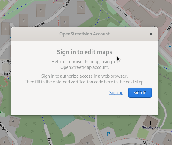
Next thing is the process for signing up with an OpenStreetMap account for editing points-of-interest.
Previously we had an implementation (which by the way was my first large contribution to Maps back in 2015) which was based on a literal translation for Java to JS of the “signpost” library used by JOSM which basically “programmatically runs” the HTML forms for requesting access to an OAuth access token when signing in with the supplied user name and password. It then presents the verification code using a WebKit web view.
This has a few problems: It involves handling passwords inside the stand-alone application, which goes against best practices for OAuth. Furthermore it implies a dependency on WebKitGTK (the GTK WebKit wrapper), which is yet another dependency that needs porting to GTK4.
So now with the new implementation we “divert” off to the user's default browser presenting them with logging in (or, if they're already logged in to OSM in the browser session (cookies) they will directly be prompted to grant access to the “GNOME Maps” application without giving credentials again. This implementation is pretty similar to how Cawbird handles signing in to Twitter.
There is also some new visual updates.
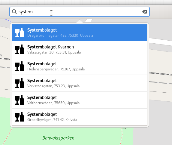
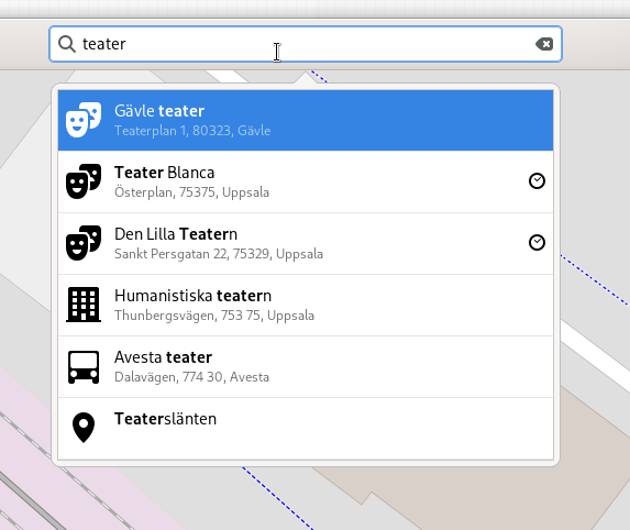
The search results now has icons for additional place types, such as fast food joints, theaters, dog parks, drink shops. I did some scouting around in the GNOME icon library 😄
Also, as a continuation of one of the last features added for 42.0, where Maps remembers if the scale stock was shown or hidden last you ran Maps when starting again. I realized the feature hiding the scale is a bit hidden (you need to look for it in the keyboard shorts menu), and also it is not possible to access on a touch-only device (such as on the Pine phone). So I added a checkbox for it under the layers menu (where I think it fits in).
And that's about it for this time.
Next time, I think there will be some more under-the-hood changes.


Yay, nice work :D
ReplyDeleteThanks!
Delete