 |
As it's now aproaching mid-September and the autumn release of GNOME, so is there also a new release of Maps approaching for GNOME 47.
Switch to Vector-based Map
The biggest change since last release is that we now use the vector-based map by default and the old raster map has also been retired since we wanted to move forward with things like enabling, and relying on clickable POIs directly in the map view so we could the remove the old tedious “What's here?” context menu doing a reverse geocoding to get details about a place (which is also a bit hit-and-miss with regards to how close to where you point the actual result is).
Apart from this other benefits we get (and this has already been mentioned in earlier posts) localized names (when tagged in OpenStreetMap) and finally a proper dark mode with our new GNOME map style.
 |
| Light (default) theme variant of the map in 47 |
 | |
| Dark theme variant of the map in 47 |
Redesigned Search Bar
The “explore” button to open the search for nearby POIs by category menu has now been integrated into the entry to avoid a theme issue when using the linked button style where the rounded corners disappears on the “other side” when the results popover is showing.
Improved Public Transit Routing
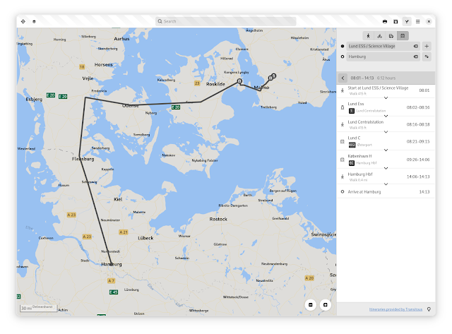
Public transit routing is now using the Transitous project (https://transitous.org) to provide transit routing for new regions. And as this is a crowd sourcing initiativ you can also help out by adding additional missing GTFS feeds to the project and it should automatically get supported by Maps.
For the time being, the regions we already supported by third-party APIs (such as Resrobot for Sweden, and OpenData.ch for Switzerland) will still use those providers to avoid possible regressions. It also gives us some leeway to improve MOTIS (the backend used by Transitous). The implementation in Maps also lacks e.g. support for specifying via locations.
 |
| Showing some travel itinerary options in Prague |
 |
| Showing a sample of an itinerary from Lund, Sweden to Hamburg, Germany |
 |
| Showing a sample of an itinerary in Denver, Colorado |
Updated Highway Shield Localizations
Thanks to the latest updates by the OSM Americana project (https://github.com/osm-americana/openstreetmap-americana) we now have some refinements in highway shield rendering.
 |
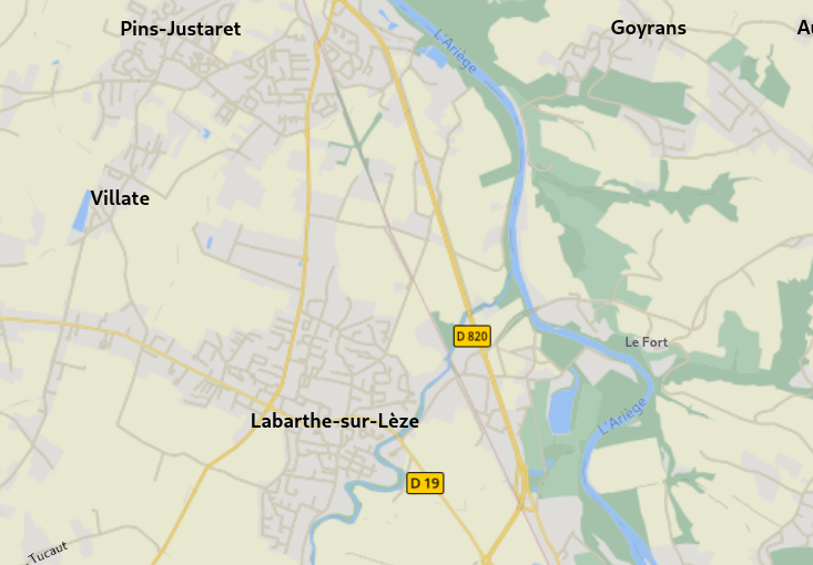
| French departmental routes (D-roads) |
 |
| Turkish national D-roads |
Some changes had to be made to our internal shield rendering library (we couldn't use the OSM Americana implementation directly, as we had to implement ours using Cairo rendering and so on) to support the new convenience shortcut for a “pill” shield shape, and also being able to define hard-coded route references “ref” directly in the shield definition rather than getting from the tile data.
 |
| Rochester Inner Loop in Rochester, New York, using a fixed “LOOP” reference label |
And on that note, a funny bug I discovered during some testing is that we currently always assume the “pointsUp” attribute in the shield definitions would always default to true when not explicitly set, while the OSM Americana code has different defaults depending on the following shape. So specifically for the “fishhead” shape it should actually be false when not set. I guess this is a bit odd to assume different values depending on following JSON elements, but…
 |
| Highway shields in New Zeeland |
It was a bit funny I discovered this bug when “browsing around“ in New Zeeland considering Northern Hemisphere-centric jokes about people “Down-under” walking upside-down 😀. But this actually also affects some highways in the US…
I guess this should be fixed before the 47.0 release.
And that's that for this time!
